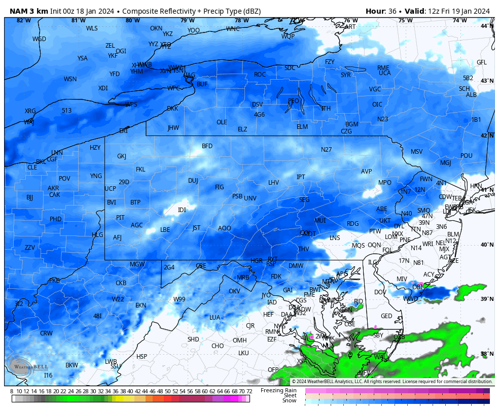
Another winter storm is on its way to the area. In less than 24 hours, many of us will be seeing snowflakes fall from the sky. Similar to this past storm, the snow will be light, to at times moderate. Snow will arrive anytime after 4:00 AM Friday morning. Snow will become steady after 7:00 AM. Below is a look at the future radar valid for 7:00 AM Friday:
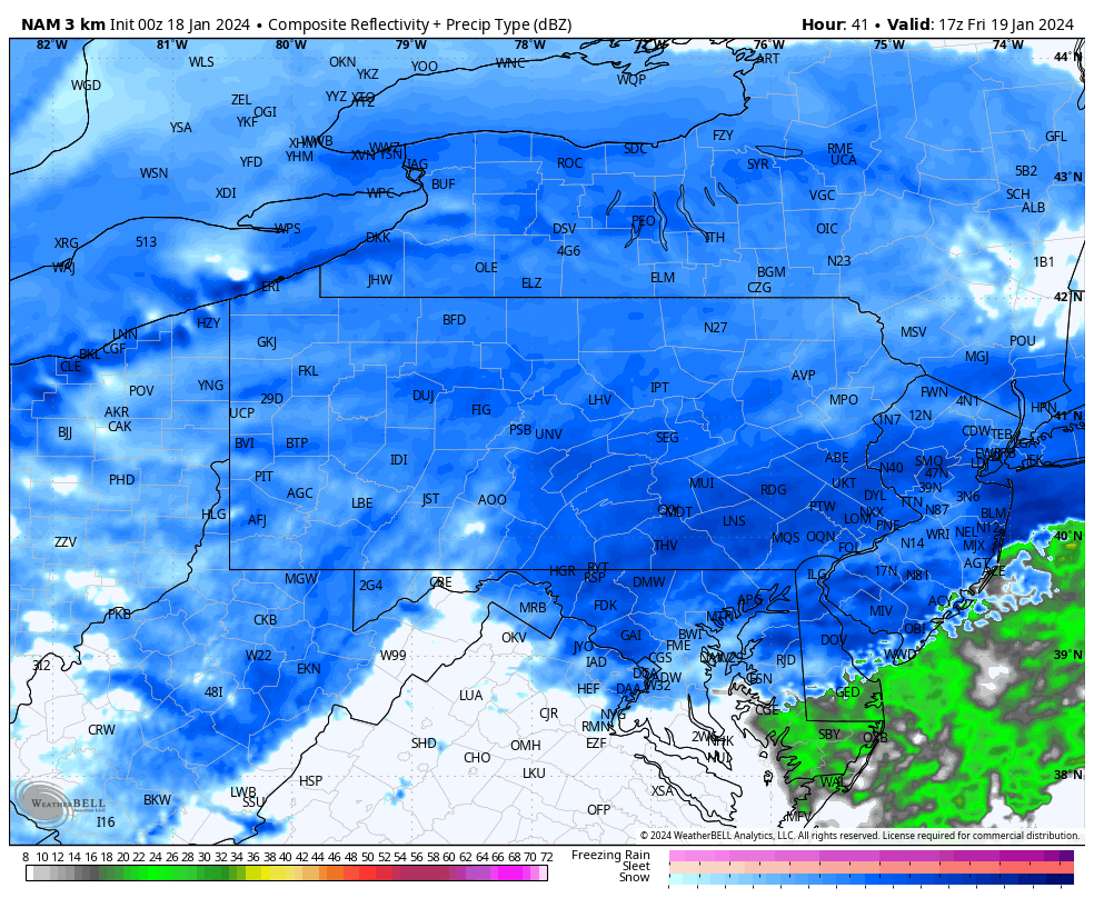
The steadiest of the snow will fall between 10:00 AM and 3:00 PM on Friday. This is when our area will see most of our accumulations. Below is a look at 12:00 PM Friday:
Snow will begin to taper off after 4:00 PM Friday afternoon, and will likely be completely shutoff by 8:00 PM Friday night.
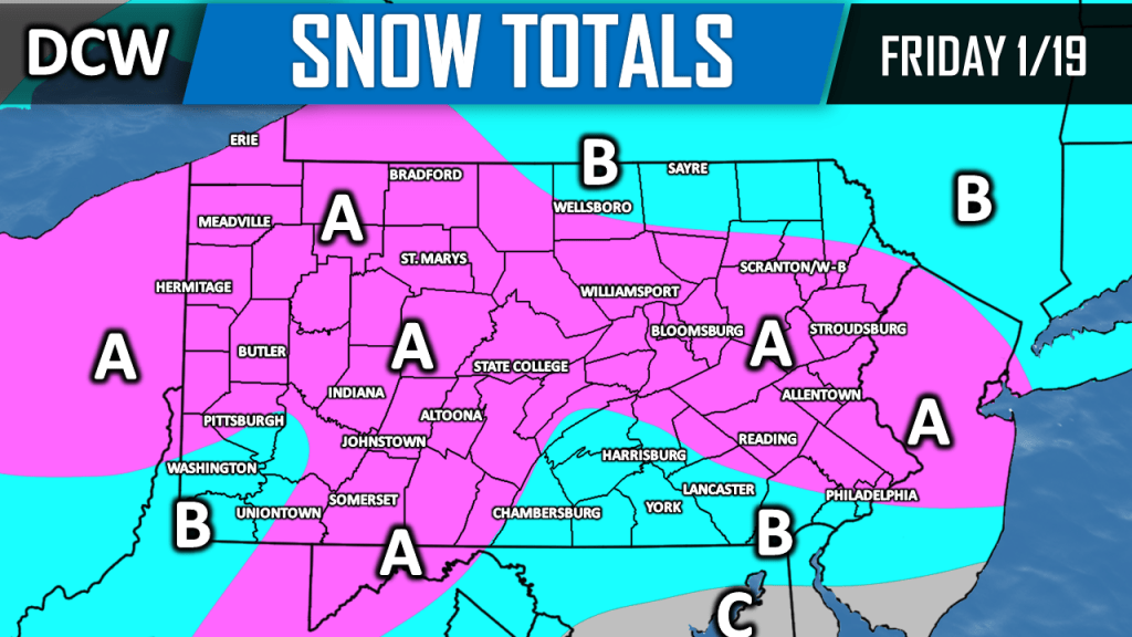
OFFICIAL SNOWFALL FORECAST:

Area A: 3 to 5 inches of snowfall is expected. Isolated higher amounts are possible.
Area B: 1 to 3 inches of snowfall is expected.
Area C: Coating to 1 inch of snowfall is expected.
Summary: Snow will begin to fly anytime after 4:00 AM Friday morning. Snow will gradually become steady after 7:00 AM. Most areas in the county will see anywhere from 1 to 3 inches of snowfall. Northern parts of the county have the best chance to see greater than 3 inches of snow. Snow will wrap up by Friday evening. Stay safe out there!

Leave a comment