I hope everyone is enjoying this NFL Playoff Sunday! While there is plenty of action on the football field this weekend, there is plenty of action happening in the weather department. First off, the winds. The winds have been ferocious over the last 24 hours and will continue to be throughout the nighttime hours.
As we move into Monday, a storm system will be approaching from the south. This storm system will bring the Lower Susquehanna Valley a period of light, to at times moderate snow. There is plenty of consensus amongst the model guidance in terms of accumulations. The only discrepancies is exactly when the snowfall will start falling across the area.
Based off the latest HI-RES NAM model, snow will begin to overspread the region from south to north between 6:00 PM and 8:00 PM Monday. The snow will remain mostly light. The best chance for bursts of more moderate snow will occur between 12:00 AM Tuesday through 6:00 AM. Below is a look at 1:00 AM Tuesday Morning:
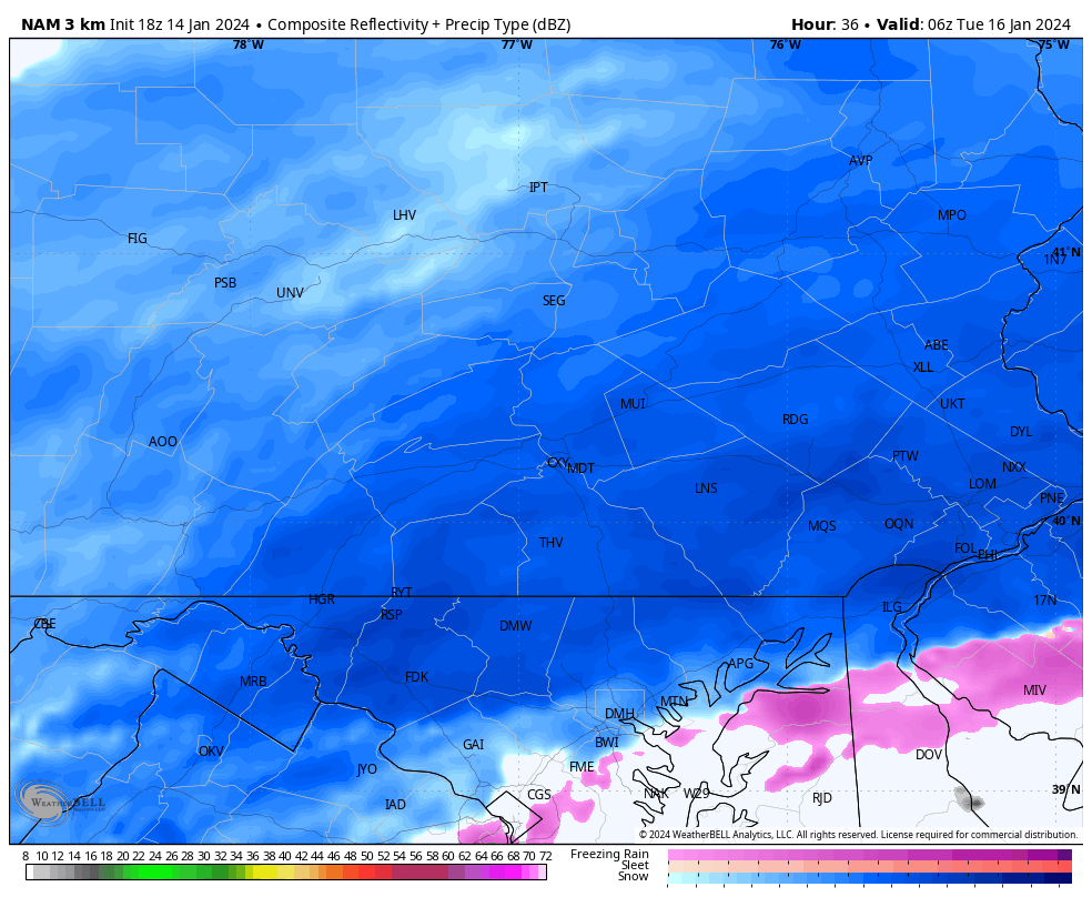
Temperatures should remain cold enough that we remain all snow throughout the area. With that said, areas that are south and east of our region, might experience some mixing issues with sleet.
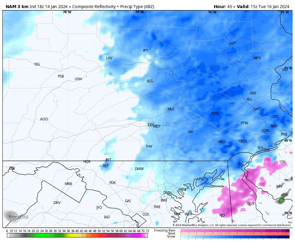
Per the latest HI-RES Nam model, it has the snow wrapping up late Tuesday Morning. This is where models become in disagreement. Some models suggest the snow will continue into the afternoon hours. Below is a look at 10:00 AM Tuesday:
Regardless of the timing, snow accumulations will remain on the lighter side. With that said, shovels and plows will still be needed across the area:
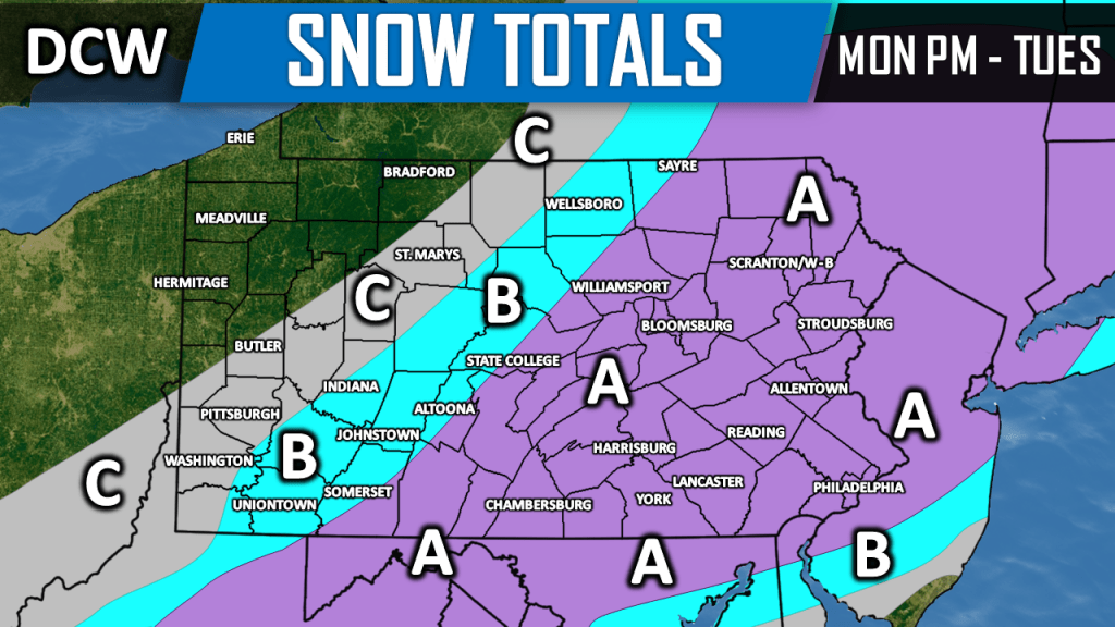
Area A: 2 to 4 inches of snowfall is likely. Isolated amounts up to 5 inches possible.
Area B: 1 to 2 inches of snowfall is likely.
Area C: A coating to 1 inch of snowfall is likely.
Summary: Snow will begin to fly Monday Evening and will continue throughout the nighttime hours. Expect travel disruptions Tuesday Morning. Snow will begin to taper off by the late morning hours Tuesday.

Leave a comment